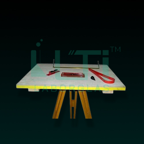
- PLANE TABLE SET (60x75cm)
- Complete with Wooden Stand & Accessories : Alidade (Sight Vane), Trough Compass, Spirit Level, Plumbob & Plumbing Fork.
- Two Types of accessories are available: Aluminium & Brass.
A plane table set, commonly used in surveying and mapping, serves various purposes in short form:
- Topographic Mapping:
- Create detailed topographic maps by plotting points and features directly on the table.
- Land Surveying:
- Conduct land surveys for property boundaries, construction projects, and infrastructure planning.
- Military Mapping:
- Support military operations by quickly mapping terrain features and strategic points.
- Geological Surveying:
- Aid in geological mapping and exploration by recording surface features and formations.
- Cartographic Drawing:
- Facilitate the creation of accurate and detailed maps through on-site drawing and plotting.
- Field Data Collection:
- Collect field data efficiently by directly sketching and recording observations on the table.
- Engineering Surveys:
- Support engineering projects by providing a platform for accurate surveying and mapping.
- Environmental Monitoring:
- Monitor and document environmental features and changes in the field.
- Infrastructure Development:
- Assist in planning and designing infrastructure projects like roads, pipelines, and utilities.
- Disaster Response Planning:
- Contribute to disaster response planning by quickly mapping affected areas and assessing damages.
- Urban Planning:
- Support urban planning initiatives by mapping and visualizing land-use patterns and developments.
- Educational Tool:
- Serve as an educational tool in surveying and cartography courses, providing hands-on experience.

